File:WGkaart.300dpi.jpg

Size of this preview: 800 × 581 pixels
Full resolution (2,655 × 1,929 pixels, file size: 3.07 MB, MIME type: image/jpeg)
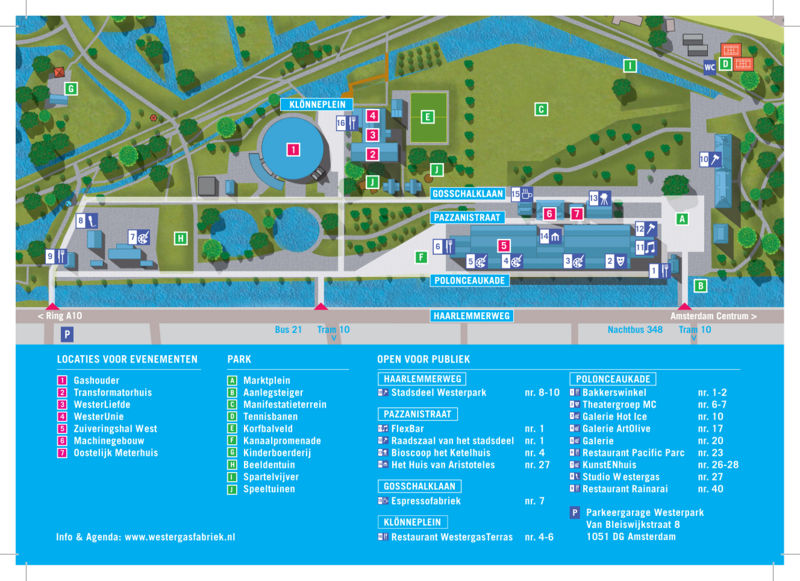
Maemo Summit 2009 location map
File history
Click on a date/time to view the file as it appeared at that time.
(Latest | Earliest) View (newer 50) (older 50) (20 | 50 | 100 | 250 | 500)| Date/Time | Thumbnail | Dimensions | User | Comment | |
|---|---|---|---|---|---|
| current | 04:11, 1 October 2009 |  | 2,655×1,929 (3.07 MB) | qgil (Talk | contribs) | (Maemo Summit 2009 location map) |
- Edit this file using an external application (See the setup instructions for more information)
File links
The following page links to this file:
Metadata
This file contains additional information, probably added from the digital camera or scanner used to create or digitize it. If the file has been modified from its original state, some details may not fully reflect the modified file.
| Orientation | Normal |
|---|---|
| Horizontal resolution | 300 dpi |
| Vertical resolution | 300 dpi |
| Software used | Adobe Photoshop CS3 Macintosh |
| File change date and time | 13:14, 16 September 2009 |
| Color space | sRGB |
- This page was last modified on 1 October 2009, at 04:11.
- This page has been accessed 1,744 times.
